

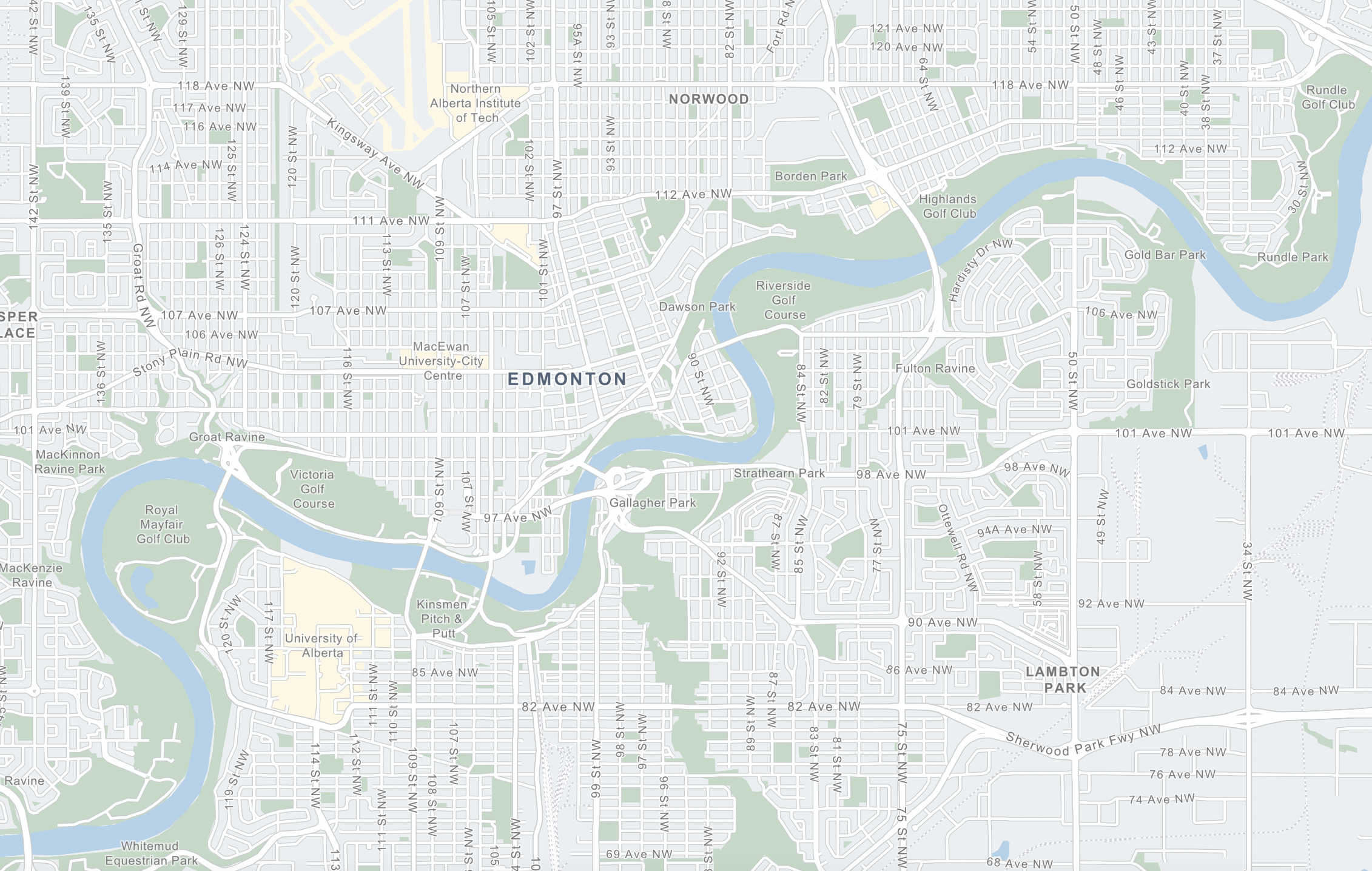
Zulima Acuña noticed that some of Edmonton’s old riverlots are highly developed, and some not at all. She asked us to help her learn why some of them became parks and others didn’t.
Zulima is a mom, teacher, and artist who has lived in Edmonton for the last ten years, and is eager to know as many stories about the land in Edmonton as her old hometown. It’s easy to take our spaces for granted: the way our roads are laid out, how big our parks are, where they are, the funny angles where some spaces meet. But Zulima’s question got us to peel back the layers a bit and see that many of the shapes and spaces we move through every day… are influenced by decisions made by land surveyors and farmers and land speculators almost a hundred and fifty years ago.
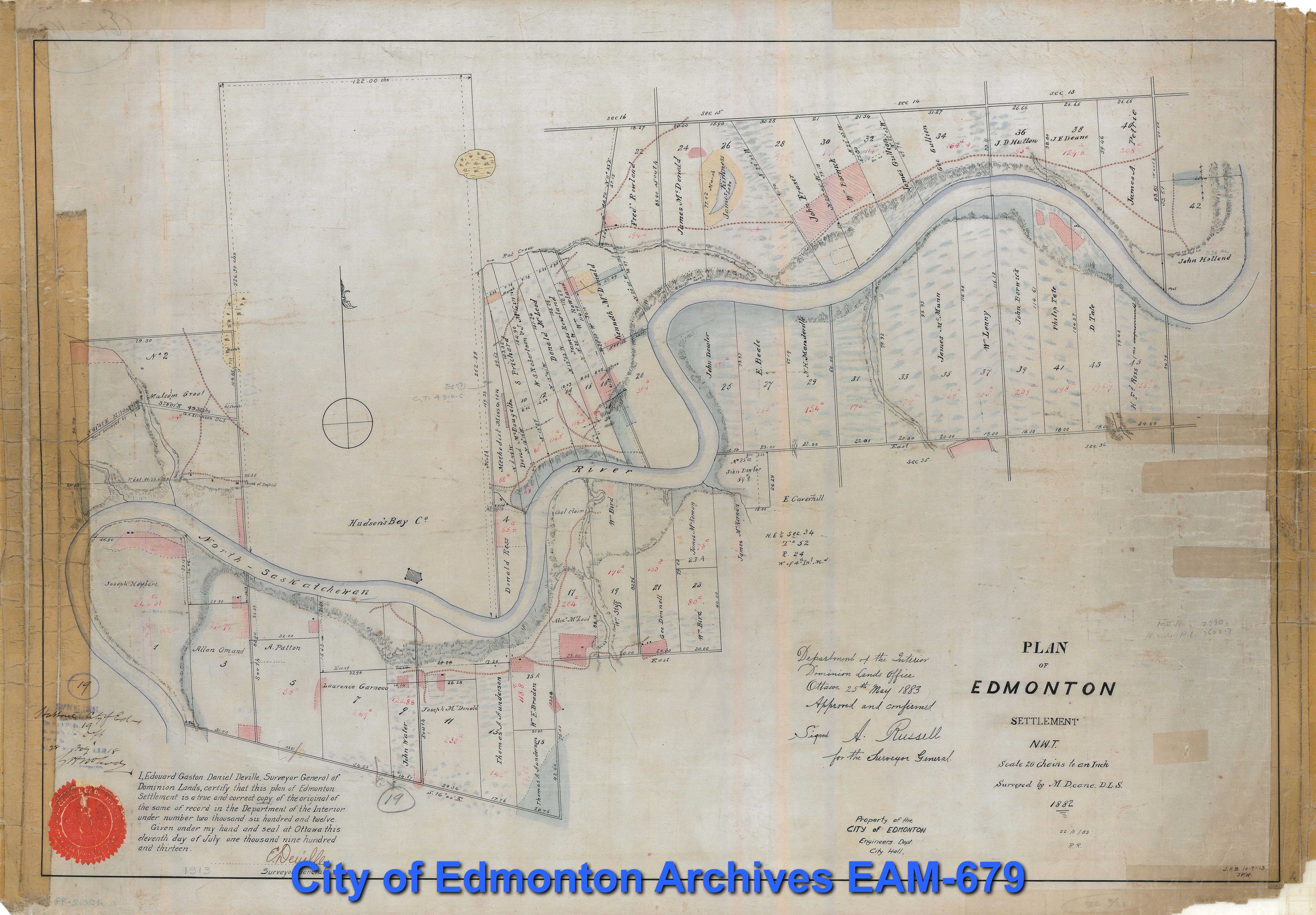
Next, we spoke to two local history researchers who have looked at the overlap between the old riverlots and the map of modern-day Edmonton. Connor Thompson is a PhD candidate at the University of Alberta, focusing on Western Canadian history. He wrote an article in 2020 for the Edmonton City as Museum Project, “Edmonton’s River Lots: A Layer in Our History”. Dylan Reade is a local documentary filmmaker and history researcher who has traced back many of the individual family stories and land sales on Edmonton’s riverlots through archival documents and maps.
Together, they helped us piece together the connections between the old riverlots and modern day places like Victoria Park, Riverdale, Borden Park, and Coronation Park.
Further Reading:
- Let’s Find Out Episode 60 – A Beautiful Ex-Garbage Dump
- Let’s Find Out Episode 58 – The MacKinnon Ravine Mystery
- “Riverlot 56: A Primer,” Kevin Ma, St. Albert Gazette, May 16, 2020.
- St. Albert’s Historic River Lots 23 & 24
